• News
  • Dashboard
  • Cases
  • Events
  • Gallery
  • Videos
  • About
Programme of the European Union - Copernicus: Europe's eyes on Earth - ESA
  • Explore data
    • Sentinel data
    • Copernicus Contributing Missions
    • Federated data sets
    • Complementary data
  • Analyse Data
    • APIs
    • Data Workspace
    • Traceability
    • JupyterLab
    • openEO
    • Sentinel Hub
    • STAC Browser
  • Ecosystem
    • Services overview
    • Services Registry
  • Copernicus Browser
  • Support
    • FAQ
    • Documentation portal
    • Community forum
    • Submit a request
    • Video tutorials
  • Login
    • Your profile
    • openEO Algorithm Plaza
    • Sentinel Hub
Menu
  1. Home
  2. Gallery

Why we have to restore mangrove ecosystems

  • Sensing date
    06.06.2023
  • Country
    India
  • Category
    Biodiversity, Coastal, Land Cover, Vegetation
  • Sensor
    Sentinel-2
view in the Copernicus browser

Show image by date:

  1. Sentinel-2_East-Kalimantan-India_Soil-Adjusted-Vegetation-Index_06062023
    June 6, 2023

International Day for the Conservation of the Mangrove Ecosystem

Did you know that mangrove forests saved an entire village from destruction in the devastating tsunami of 2004? Not surprising, since mangroves are nature’s solution to prevent coastal erosion, reduce atmospheric carbon and protect land against flooding.

And still, we have lost half of all mangrove forests since 1980, due to man-made environmental changes. Especially in Indonesia, which harbors the perfect conditions for mangroves to grow, but at the same time has the world’s highest rate of mangrove loss.

Conversion of mangrove forests into ponds

In the Indonesian province East Kalimantan, mangrove forests have been systematically converted into ponds. In 1990, the mangroves covered an area of 268,147 Ha. By 2000, this area was already reduced by 15%. And in 2019, it decreased once again by 5%, leaving 215,514 Ha. Thanks to the Sentinel-2 satellite imagery, we can easily identify the dynamics of mangroves and ponds from year to year.

Restoration of mangrove ecosystems

On the International Day for the Conservation of the Mangrove Ecosystem, we focus on the importance of mangroves. By 2024, Indonesia aims to restore 630,000 hectares as part of its mitigation plan against climate change. Our satellite images help to map the areas of degraded mangrove, so we can start restoring them.

Track how Indonesia restores its mangrove ecosystems? With Copernicus you can!

This Sentinel-2 L2A image shows the mangrove forest vegetation on June 6th, 2023 in the Mahakam River area in East Kalimantan, Indonesia.

view in the Copernicus browser

Download the high resolution image

  • sentinel-2_east-kalimantan-india_soil-adjusted-vegetation-index_06062023_hr.jpg (jpg, 2.12 MB)

Share this image:

  • Share on Twitter
  • Share on Facebook
  • Share on Instagram

Related images

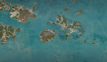
  • Sentinel-2 True Colour image of Wando County South Korea from 6 April 2025 clean
    • June 4, 2025
    • South Korea
    • Coastal, Human Activities, Marine

    A Sentinel-2 view on Aquaculture in South Korea

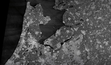
  • Sentinel-1 SAR satellite image of Ijselmeer Netherlands 13 May 2025 clean
    • May 13, 2025
    • Netherlands
    • Agriculture, Coastal, Marine, Urban

    Celebrating 50 years of ESA with a Sentinel-1 view

    • April 1, 2025
    • Finland
    • Coastal, Snow and Ice

    The freezing and thawing of the Bay of Bothnia

Programme of the European Union - Copernicus: Europe's eyes on Earth - ESA
  • Explore data

    • Sentinel data
    • Copernicus Contributing Missions
    • Federated data sets
    • Complementary data
  • Analyse Data

    • APIs
    • Data Workspace
    • Traceability
    • JupyterLab
    • openEO
    • Sentinel Hub
    • STAC Browser
  • Ecosystem

    • Services overview
    • Services Registry
  • More

    • Copernicus Browser
    • Support
    • Login
    • News
    • Dashboard
    • Cases
    • Events
    • Gallery
    • Videos
    • About

Newsletter

Do you have questions?

Contact us via the about page

  • RSS
  • YouTube
  • Twitter
  • Facebook
  • Instagram
  • Linkedin
  • Newsletter
  • Terms and conditions
  • Cookie Policy
  • Privacy policy
Programme of the European Union - Copernicus: Europe's eyes on Earth - ESA
Close
  • Explore data

    • Sentinel data
    • Copernicus Contributing Missions
    • Federated data sets
    • Complementary data
  • Analyse Data

    • APIs
    • Data Workspace
    • Traceability
    • JupyterLab
    • openEO
    • Sentinel Hub
    • STAC Browser
  • Ecosystem

    • Services overview
    • Services Registry
  • News
  • Dashboard
  • Cases
  • Events
  • Gallery
  • Videos
  • About
  • Copernicus Browser
  • Support
  • Login