• News
  • Dashboard
  • Cases
  • Events
  • Gallery
  • Videos
  • About
Programme of the European Union - Copernicus: Europe's eyes on Earth - ESA
  • Explore data
    • Sentinel data
    • Copernicus Contributing Missions
    • Federated data sets
    • Complementary data
  • Analyse Data
    • APIs
    • Data Workspace
    • Traceability
    • JupyterLab
    • openEO
    • Sentinel Hub
    • STAC Browser
  • Ecosystem
    • Services overview
    • Services Registry
  • Copernicus Browser
  • Support
    • FAQ
    • Documentation portal
    • Community forum
    • Submit a request
    • Video tutorials
  • Login
    • Your profile
    • openEO Algorithm Plaza
    • Sentinel Hub
Menu
  1. Home
  2. Gallery

Celebrating the very beginning

  • Sensing date
    26.11.2023
  • Country
    Italy
  • Category
    Land Cover, Urban, Vegetation
  • Sensor
    Sentinel-2
view in the Copernicus browser

Show image by date:

  1. Sentinel-2 image of Frascati, Rome 26 November 2023
    November 26, 2023

Throwback to the kick-off meeting in Frascati

A clear view of the Frascati - or anywhere else in the world - is just a few clicks away. Amazing, right? With this image we take you back to the very beginning of the Copernicus Data Space Ecosystem and the official kick-off meeting which took place one year ago at ESA ESRIN in Frascati. Frascati is located in the Metropolitan City of Rome Capital, one of the 5 provinces of the Lazio region in Italy.

Using satellite images has never been easier, thanks to the Copernicus Data Space Ecosystem, an innovative platform and ecosystem for the Copernicus Sentinel data after the legacy ESA distribution hubs and existing DIAS platforms. The goal? Making satellite data available for everyone, simple and completely free.

Understanding the effects of climate change

The world of satellite data has long remained in the niche field of researchers and intelligence communities. With the kick-off of the Copernicus Data Space Ecosystem, the satellite data of Copernicus became available for a broad audience of public authorities, commercial companies and even individual citizens. Through various interfaces, users from all over the world can easily access, process and analyze satellite data for personal, commercial, or research objectives.

Anyone can benefit from getting a clearer view on our planet. This is why the Copernicus Data Space Ecosystem aims to reach all members of society, enabling them to better understand and mitigate the effects of climate change in order to create a more sustainable future for all. A huge step in making an impact for everyone on our planet.

New roadmap for 2024

The Copernicus Data Space Ecosystem is continuously upgraded. In the new roadmap we give a clear overview of which data and services are recently made available, and which you can expect the first months of 2024.

CDSE_Roadmap_Update_04_2024

The Copernicus Data Space Ecosystem in figures

All our services are constantly monitored to offer real-time insights into system usage and the amount of data available with various metrics. The Copernicus Dashboard gives you multiple insights into the current operational state, user activity, and service health. Here are some first insights:

  • 62.44 PB of Sentinel data available
  • 86 798 registered users (daily increase)
  • 44.22 M data visualization requests
  • 106.75 M published products

Download the high resolution image

  • 2023-11-26-00_00_2023-11-26-23_59_sentinel-2_l2a_true_color.png (png, 8.81 MB)
  • Happy Holidays

Holidays Service Desk

With the upcoming holidays we want to inform you that the Copernicus Data Space Ecosystem User Support will be unavailable on the 25th of December 2023 and 1st of January 2024.

Share this image:

  • Share on Twitter
  • Share on Facebook
  • Share on Instagram

Related images

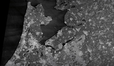
  • Sentinel-1 SAR satellite image of Ijselmeer Netherlands 13 May 2025 clean
    • May 13, 2025
    • Netherlands
    • Agriculture, Coastal, Marine, Urban

    Celebrating 50 years of ESA with a Sentinel-1 view

  • CDSE February 2025 desktop image sentinel-2_l1c_custom Algeria
    • December 19, 2024
    • Algeria
    • Land Cover, Mountains

    February 2025 desktop background

  • Sentinel-2 L1C image of Belasica Mountain Range on 18 December 2024 clean
    • December 18, 2024
    • Bulgaria, North Macedonia, Greece
    • Land Cover, Mountains, Snow and Ice

    The Belasica Mountain Range by Sentinel-2C

Programme of the European Union - Copernicus: Europe's eyes on Earth - ESA
  • Explore data

    • Sentinel data
    • Copernicus Contributing Missions
    • Federated data sets
    • Complementary data
  • Analyse Data

    • APIs
    • Data Workspace
    • Traceability
    • JupyterLab
    • openEO
    • Sentinel Hub
    • STAC Browser
  • Ecosystem

    • Services overview
    • Services Registry
  • More

    • Copernicus Browser
    • Support
    • Login
    • News
    • Dashboard
    • Cases
    • Events
    • Gallery
    • Videos
    • About

Newsletter

Do you have questions?

Contact us via the about page

  • RSS
  • YouTube
  • Twitter
  • Facebook
  • Instagram
  • Linkedin
  • Newsletter
  • Terms and conditions
  • Cookie Policy
  • Privacy policy
Programme of the European Union - Copernicus: Europe's eyes on Earth - ESA
Close
  • Explore data

    • Sentinel data
    • Copernicus Contributing Missions
    • Federated data sets
    • Complementary data
  • Analyse Data

    • APIs
    • Data Workspace
    • Traceability
    • JupyterLab
    • openEO
    • Sentinel Hub
    • STAC Browser
  • Ecosystem

    • Services overview
    • Services Registry
  • News
  • Dashboard
  • Cases
  • Events
  • Gallery
  • Videos
  • About
  • Copernicus Browser
  • Support
  • Login